Aerial Maps Show How Ancient Farms and Roads Are Still Visible Today
There’s so much you can see from above.

There are many stories news stories about artifacts buried in the ground that people find by accident. Unless you have a metal detector or are a professional hard evidence of the centuries past can be hard to find. But, new aerial images show just how much of of the ancient is world is still with us- and still quite visible today in overhead images of England.
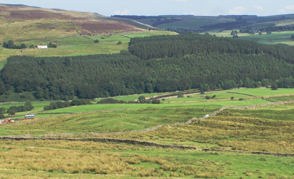
Historic England have recently unveiled a new tool that shows a variety of aerial photos from across the country. What cannot be seen on the ground becomes more apparent from above as the outlines of houses and pasture walls from antiquity can still very plainly be seen from the sky.
A truly brilliant photo shows a pasture from above as the sun is setting. In this light the ever-so-slight difference in the soil heights shows a variety of prehistoric settlement and farming traces, such as hedgerows, building foundations, and other traces.
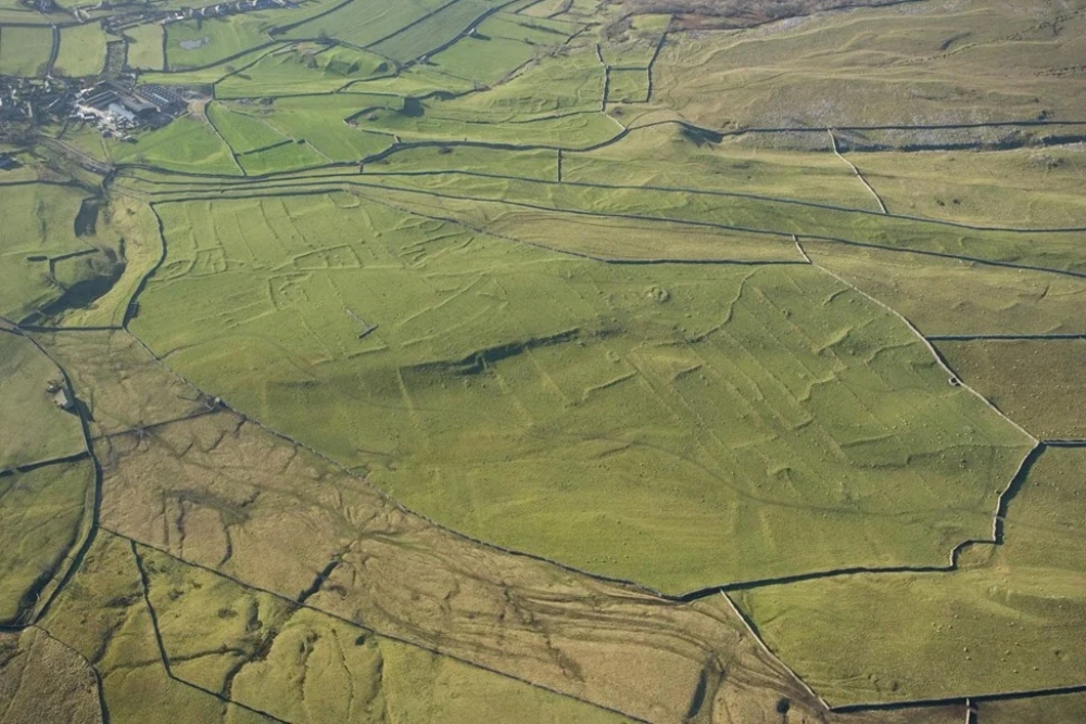
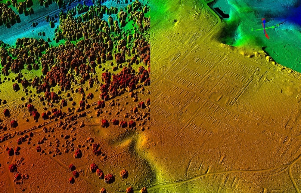
Roman forts that cannot be seen from the ground are visible from above, showing a world under the top layer of soil. Causeways, old mines, manmade mounds, cold-war bunkers, and ancient farming furrows that peak through the now-flat pastures reveal how the land was used in the past. Also visible on the map are aerial Lidar (Light detection and ranging) images that show in detail how the past is hiding just under the surface.
The tool also shows how these archaeological sites sprawled over larger areas and gives an idea of the vast amount that we cannot see without distance and special tools like Lidar. This new field of exploration is known as aerial archaeology, which is unlike the conventional archaeology. Instead of digging things up and/or studying them at close range or even taking samples from prehistorical objects, distance is what makes this type of archaeology unique.
The new Aerial Archaeological Mapping Explorer has layers that also display where landmarks, historic investigations, and various categories of historic information searchable for free. More than 500,000 images were used in making the map, sourced over the span of 30 years.
The oldest features on the map are estimated to be around 6,000 years old, with a majority of England appearing on the detailed map. In a statement Historic England called the new map tool “a huge archaeological jigsaw puzzle”. They also added that new information is coming in all the time and will be added to the map in an ever-enlarging database.
Duncan Wilson, Chief Executive of Historic England, said in a statement that the “mapping tool lets people fly virtually over England and drink in its many layers of history.”
SKM: below-content placeholderWhizzco for DOT